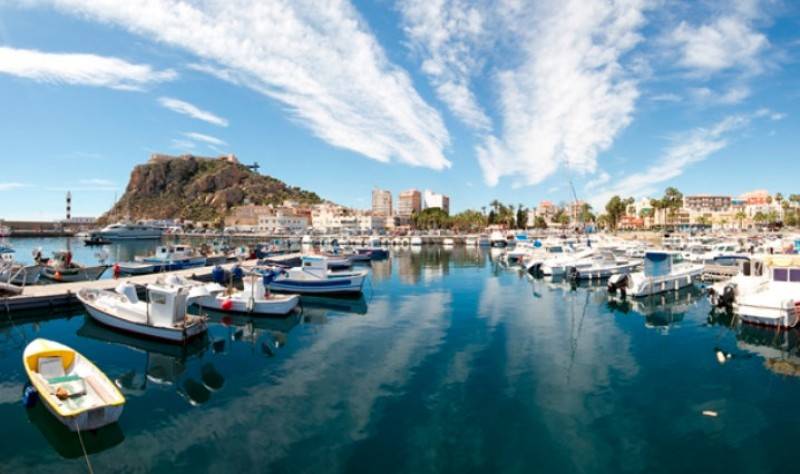
Fishing has played a vital role in the life and development of Águilas over the centuries This guided tour takes participants on an informative journey through the history of fishing in Águilas, visiting two natural mooring sites which have been used by boats for centuries, marking the identity and way of life of the coastal town. The walk begins at the Puerto de Levante, the eastern port, where the first manmade structure was a simple stone..
READ MORE
A 2-hour walk on the environmentally friendly route along the seafront of Águilas town centre The network of “Senderos Azules” is an initiative promoted in Spain by ADEAC, the Association of Environmental and Consumer Education, to recognize and promote sustainable and environmentally friendly walking paths, this contributing to the enjoyment and preservation of nature and ethnographic heritage. The “Tres Bahías” (Three Bays) route..
READ MORE
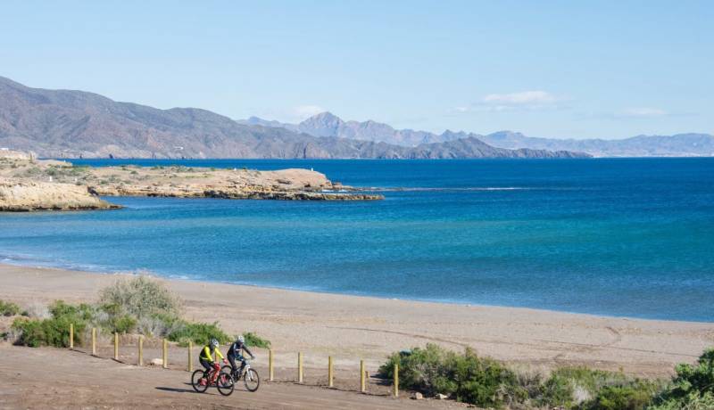
An eco-friendly walking and cycling route at the western end of the Águilas coastline The network of “Senderos Azules” (Blue Trails) is an initiative promoted in Spain by ADEAC, the Association of Environmental and Consumer Education, to recognize and promote sustainable and environmentally friendly walking paths, this contributing to the enjoyment and preservation of nature and ethnographic heritage. The “Los Cocedores” route in Á..
READ MORE

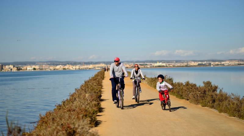
An eco-friendly walking and cycling route encompassing the three main bays of the Águilas coastline The network of “Senderos Azules” is an initiative promoted in Spain by ADEAC, the Association of Environmental and Consumer Education, to recognize and promote sustainable and environmentally friendly walking paths, this contributing to the enjoyment and preservation of nature and ethnographic heritage. The “Tres Bahías” (Three Bays..
READ MORE
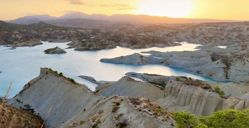
Icy cold springs, moonscapes, badlands and enchanted natural cities in the Costa Cálida! Far from being simply a stretch of coastline in the western Mediterranean, the Region of Murcia has a fantastically varied landscape, and the following selection has been made by the regional tourism institute (ITREM) to illustrate this wealth of natural beauty! Salto del Usero Just outside the town of Bullas is the popular beauty spot of the Salto..
READ MORE
One stage of 7,560-km route which runs from Cádiz to Cyprus ends in Águilas and the next sets out for Puerto de Mazarrón The Region of Murcia has long been a preferred destination for cycling holidays, the varied terrain attracting tourists from all over Europe 12 months a year, and its inclusion on the “EuroVelo 8” route, which runs a massive 7,560 kilometres from Cádiz in the south-west of Spain to Athens and Cyprus, is likely to further..
READ MORE
Easily manageable sections of the 7,560-km route which runs from Cádiz in south-western Spain to Athens and Cyprus! The Region of Murcia has long been a preferred destination for cycling holidays, the varied terrain attracting tourists from all over Europe 12 months a year, and its inclusion on the “EuroVelo 8” route, which runs a massive 7,560 kilometres from Cádiz in the south-west of Spain to Athens and Cyprus, is likely to further cement..
READ MORE
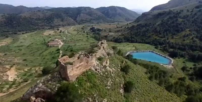
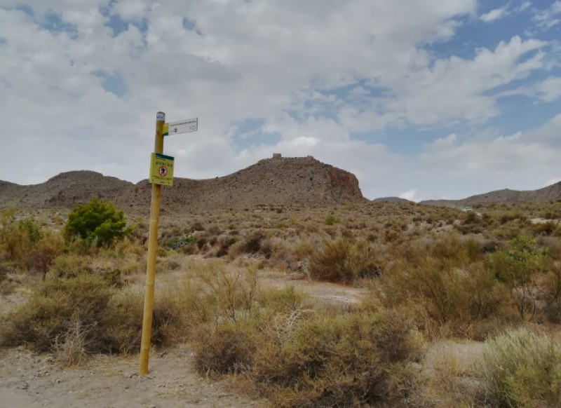
An 11th century fortification in Águilas which was strategically important in the conflicts of the Middle Ages Image: Consejo de Agricultura Ecológica de la Región de Murcia - Caerm The ruined castle of Chuecos stands at an altitude of 687 metres above sea level on a hill in the Sierra de Almenara and was built to protect and make use of a historic natural spring which lies just below. To the north is the Casa de Chuecos and the small church..
READ MORE
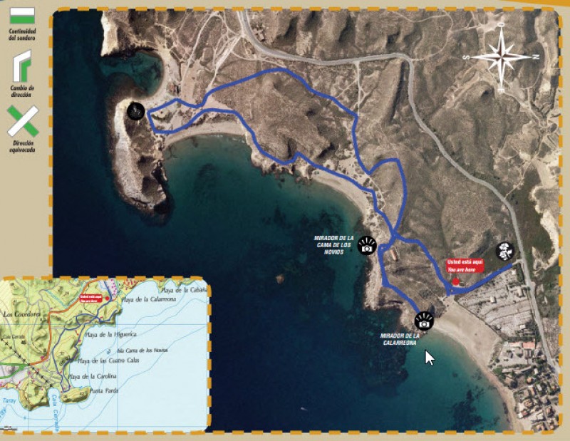
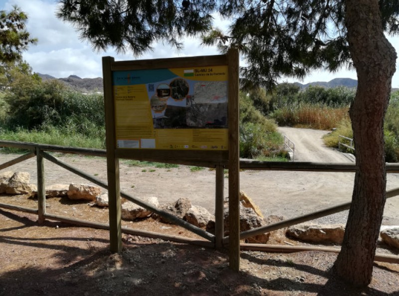
Four beaches and a fascinating array of flora and fauna on a short coastal walk in Águilas Details of the SL-MU 18 Cuatro Calas walk Start and finish: Playa de Calarreona Distance: 4 kilometres including detours, 2.8 km without detours Duration: 60 minutes for the circular route, 90 minutes including detours Total ascent and descent: 130 metres The SL-MU 18 “Cuatro Calas” footpath follows a route which is entirely within..
READ MORE
The PR-MU 104 route offers spectacular views from the lower slopes of Cabo Cope Cabo Cope is the imposing headland which juts out into the Mediterranean next to the village of Calabardina, in the municipality of Águilas, reaching a height of 242 metres and dominating the landscape. At the same time it is part of the natural park of Cabo Cope and Puntas de Calnegre, declared a Site of Community Interest on account of its tectonic and geomorphological..
READ MORE
A 22-kilometre stretch of the route follows the Águilas coastline As well as being home to various recommended rural walking routes, the municipality of Águilas is also one of the many visited by the GR-92 route which runs along the whole of the Mediterranean coast of Spain from the border with France to Tarifa, in the province of Cádiz. The Águilas section hugs the coastline closely from Playa de la Galera in the north to Playa de..
READ MORE
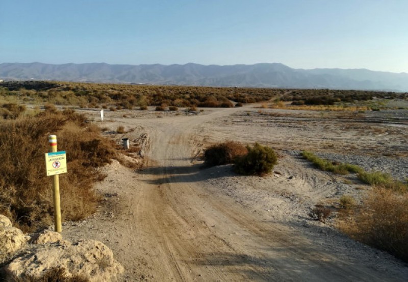
The PR-MU 112 walk is in the mountains which stand to the north of Águilas The route lies within an area which is included in the Natura 2000 network as a Site of Community Importance and is a ZEPA birdlife protection zone, due to the presence of species such as the eagle owl, the peregrine falcon and the Bonelli’s eagle. The route is also home to other protected species such as the spur-thighed tortoise. A circular route, it initially..
READ MORE
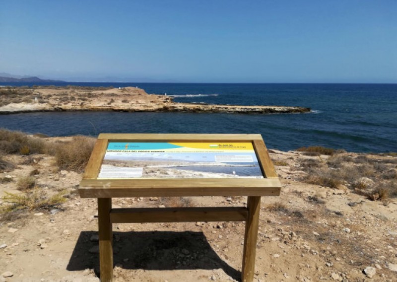
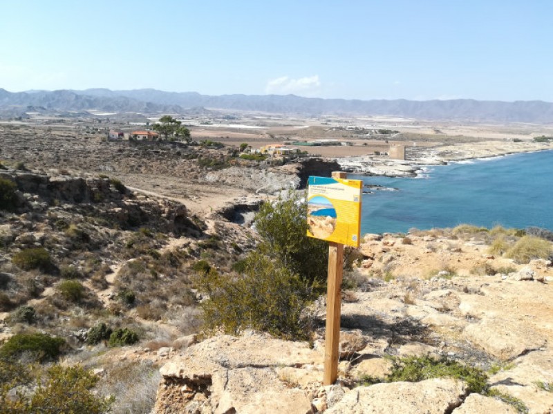
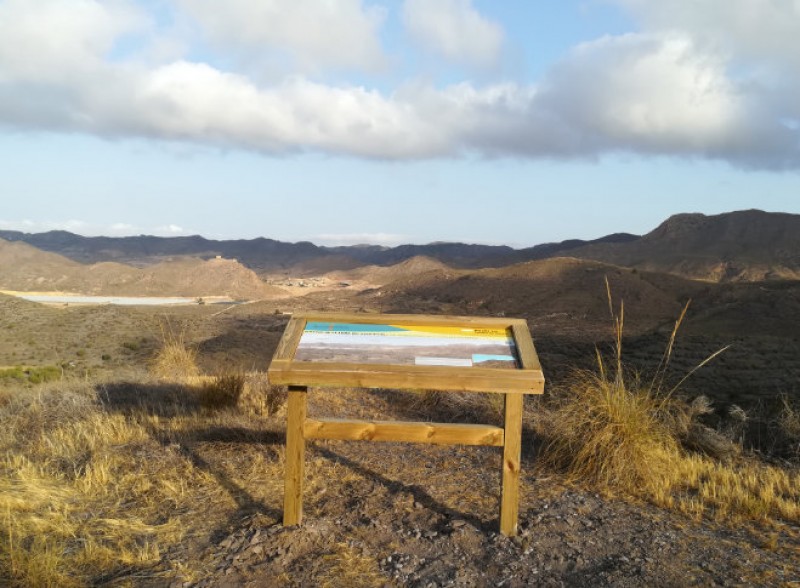
The SL-MU 23 walk includes wild beaches, a Roman jetty and a nuclear spring! The route lies entirely within the Regional Park of Cabo Cope y Puntas de Calnegre, and allows walkers to appreciate the natural and cultural heritage which make the area deserving of this status. Along the way are nesting sites used by various bird species, beautiful coves, the remains of Roman settlements, a small crypto-wetland at the Playa del Saladar and even..
READ MORE
The PR-MU 113 route is an 18-kilometre walk from the mountains behind Águilas to the town centre This route is named after the old water supply channel from Tébar to Águilas, a canal which was built on the orders of King Carlos III in the 18th century with the aim of providing infrastructures for the growing town of Águilas. It is a linear route of which all but 3 kilometres follows tarmacked road surfaces, and on either side are intensive..
READ MORE
The walk follows the route of the annual Romería del Rocío in Águilas This is a linear walk rather than a circular route, running from the Plaza de la Guardia Civil in the town of Águilas to the Molino del Saltaor beauty spot, and the route is very similar to the one followed during the annual “Romería”, when the figure of the Virgen del Rocío is carried to the mill and spends the night there before returning to the church of San..
READ MORE